The Novgorod region has been known since ancient times for its rivers, many of which were part of important trade routes. Now the rivers of the Novgorod region are popular as an object of water tourism, especially during the spring flood. The fast current and the abundance of rocky rapids are also of interest to fans of extreme river rafting.
Most of the rivers in this region originate in the Valdai Upland, from the reservoirs of the Valdai National Park. The most famous rivers of the Novgorod region are Lovat, Volkhov, Mologa, Msta. They are navigable and are also famous among anglers for their variety of fish species. The valleys of some rivers have been declared specially protected natural objects.
The longest rivers of the Novgorod region
List of the largest rivers flowing through the region.
Lovat
It flows through the territory of three regions at once - the Vitebsk region of the Republic of Belarus, the Pskov and Novgorod regions of the Russian Federation. It originates from Lake Lovatets, its mouth is Lake Ilmen in the Novgorod region. In the old days, the river was used by the trade route "from the Varangians to the Greeks" and the Volga waterway. In some areas Lovat is navigable. Suitable for boating and fishing.
The total length of the river is 530 km.

Mologa
It flows in the Tver, Vologda and Novgorod regions. The source of the river is located on the Valdai Upland. Near the town of Pestovo, Novgorod Region, the channel width is about 100 meters. Mologa is navigable. Mainly pine and spruce forests grow on the shores. Translated from the Finno-Ugric "Mologa" - "fish river", until recently, it was inhabited by rare species of fish - sturgeon, sterlet.
The total length of the river is 456 km.

Msta
It flows on the territory of the Tver and Novgorod regions. The river originates from the Mstinsky reservoir and flows into Lake Ilmen. In the lower reaches, the river is navigable, in the middle reaches it crosses the Borovichi or Mstinsky rapids - one of the most popular places for water tourism. The speed of the river in the area of the rapids is about 20 km / h. In the old days, Msta was part of the road "from the Varangians to the Greeks." The name comes from the Finno-Ugric musta - "black", associated with the peaty color of the water.
The total length of the river is 445 km.

Meadows
The river originates in the Tesovskie bogs near the village of Tesovskiy in the Novgorod region and flows into the Gulf of Finland in the Leningrad region. The name of the river comes from the Finnish laug - "shallow" or from the Estonian laugas - puddle, pit. The meadows are known among fishermen as a river rich in fish; there are crucian carp, pike, rudd, perch, tench, etc. During spawning, salmon and eel are found.
The total length of the river is 353 km.

Paul
It originates from the Valdai Upland and flows into Lake Ilmen. The name of the river is a village in the Parfinsky district of the Novgorod region. Not far from the mouth, the Pola is connected by a channel with the Lovat River. The general direction of the channel is northwest. The part of the Paula below the channel is also called Vergot. The river is popular as a water tourism destination. It flows in the Tver and Novgorod regions.
The total length of the river is 268 km.

Syas
The river flows in the territory of the Leningrad and Novgorod regions. The source is located on the Valdai Upland in the Lyubitinsky District, the mouth is Lake Ladoga. In ancient times, Syas was part of the Volga-Baltic waterway ("from the Varangians to the Arabs"). The river is known for its reddish-brown water color. This is due to the fact that the bottom is rich in iron oxide. Syas is rich in fish - pike, ide, pike perch, burbot, tench, ruff, etc. The name of the river comes from the Finno-Ugric "mosquito".
The length of the river is 260 km.

Shelon
The source of the river is located in the Dedovichi district of the Pskov region. Shelon flows into Lake Ilmen, Novgorod region. On the territory of the Novgorod region, the river is expanding, near the town of Soltsy, the width is 70 meters, in the village of Shimsk - 300 meters, at the confluence with Lake Ilmen - about 3 km. Known in history as the site of the Battle of Sheloni in 1471. The river is home to perch, bream, burbot, roach, pike, and other types of fish.
The total length of the river is 248 km

Cunya
The river originates in the Pskov region, crosses the Tver region and flows into the Lovat River in the town of Kholm, Novgorod region. The width in the territory of the Novgorod region is about 80 meters. It is an object of water tourism as a frequent route for water rafting. During the flood period it overflows heavily. The valley is a specially protected natural site of regional importance. Almost all tributaries of the river are right-handed, the largest are the Serezha, Bolshoi and Maly Tuder, Usvyata rivers.
The total length of the river is 236 km

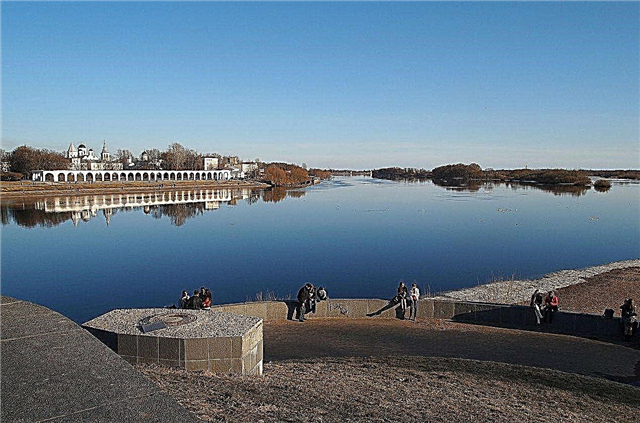
Volkhov
It is known as the only river that originates in Lake Ilmen. The estuary is Lake Ladoga. On the river are located Veliky Novgorod, pos. Red-porcelain. There is a mention of Volkhov in the annals, where it was mentioned that the waters can flow backwards. The current stops at the present time, due to the low water level in Lake Ilmen. It flows on the territory of the Novgorod, Pskov and Leningrad regions.
The total length of the river is 224 km.

Kobozha
It originates in Lake Velikoye in the Novgorod Region and flows into the Mologa River in the Ustyuzhensky District of the Vologda Region. On the river is the village of Kabozha, Khvoininsky district, not far from it is the dam of the shutdown hydroelectric power station. The water has a brownish color, this is due to the peaty bottom soils. On the banks there are coniferous forests. The river is known for fishing and boating.
The total length of the river is 184 km.

Leaf
The Lovati tributary, which flows through the Pskov and Novgorod regions. The source is Lake Polisto in the Pskov region. It flows into Lovat 3-4 km above the confluence of the Lovati and Ilmen. On the territory of the Novgorod region, the current is weak, the channel width is 30-40 km. In the area of the village of Braklovitsy there are large water rapids. Interesting for water tourists during the spring flood.
The total length of the river is 176 km.

Pchevzha
The source is located in the Lyubytinsky district of the Novgorod region. The mouth is the Volkhov River in the Leningrad Region. Not far from the source, the river is narrow, the channel is winding, there are many rocky rifts. The banks are swampy. Closer to the confluence of the Rapli River, more coniferous forests grow on the banks. The water is brown-peaty.
The total length of the river is 157 km.

Break
Right tributary of the Pola River. The source is on the Valdai Upland (Russkoye Lake). In the upper and middle reaches, the stream is fast, there are rocky rapids and rifts. On the bank of Polometi in 2003, a memorial sign was erected - Ignach Cross in the tract of the same name. It symbolizes the victory of the Novgorodians over the Tatar-Mongol army in the 13th century. The river flows only in the territory of the Novgorod region.
The length of the river is 150 km.

Berezaika
Tributary of the Msta River. It flows in the Tver and Novgorod regions. The source is Lake Berezai on the Valdai Upland. On the territory of the Novgorod region, the river bed is narrow and meandering - up to 10-15 meters wide, after crossing with a chain of lakes the width of the river bed increases. It is an object of water tourism as the beginning of the route along the Msta.
The total length of the river is 150 km.

Redya
Left tributary of the Lovati. The source is located in the Rdeysky nature reserve, on the territory of the Chomsky district. Near the source, the river flows in the form of a small stream, then the current accelerates and the channel becomes wider, there are rocky rapids. Coniferous forests appear on the banks. The village is located on the river. Poddorye, the villages of Kiev, Kryukovo. It flows only in the Novgorod region.
The length of the river is 146 km.

Dog
It originates in Lake Rakitinskoye on the territory of the Khvoininsky District of the Novgorod Region, flows into the Chagoda River on the territory of the Vologda Region. The river bed is rocky, the current is fast, there are many rapids. During the spring flood it overflows heavily.Known as a water tourism destination, it is popular with fishermen. Crosses the village of Khvoinaya, the village of Pes.
The total length of the river is 145 km.

Tigoda
The river flows out of the Tesovskiye bogs near the village of Ogorelye, Novgorodsky district, and crosses the Chudovsky district. It flows into the Volkhov in the Leningrad Region. On the banks there are birch-aspen and coniferous forests. The river is floatable and is a popular water tourism destination. Perch, pike, ide, roach, bleak and other types of fish are found.
The total length of the river is 143 km.

Porosia
Tributary of the Polist River. It flows out of the swamps of the Rdeysky reserve, crosses more than 40 settlements of the Starorussky and Poddorsky districts. The last section of the river before the confluence with Polist is called Pererytitsa. The banks are swampy, the water has a peaty hue. There are many medicinal plants on the shores, there are rare species. Of fish - mostly chub.
The length of the river is 142 km.

Holova
Left tributary of the Msta. The source is Lake Borovno on the Valdai Upland. Crosses Okulovsky, Krestetsky, Valdaysky, Malovishersky districts. The Valdai National Park is located at the source. In the upper reaches of the river on the banks there is a mixed forest, in the lower reaches there are predominantly conifers. There are many species of fish, including rare ones. The river is known as a water tourism destination.
The length of the river is 126 km.

Oskuya
The right tributary of the Volkhov, originates in the Amelnikovsky swamp (Malovishersky district). The current is weak, during the flood the channel spills up to 100 meters wide. In the lower reaches it is navigable, popular as a place for tourist rafting on the river. A variety of fish species are found. The main attraction on the banks is the village of Oskuy with the former estate of the gold miner Lyubishchev.
The length of the river is 114 km.

Mshaga
Left tributary of the Sheloni. The source is the Vereteyka tract. Crosses the Soletsky and Shimsky districts. The mouth of the river was previously known as the site of large salt exploration near the villages of Mshaga Yamskaya and Novaya Sol. In ancient times, the river was part of the Luga trade route. Near the mouth of the Mshaga it is navigable - the width of the channel is 15-20 meters, at the source it becomes shallow, rocky rifts appear.
The length of the river is 106 km.

Kerest
The left tributary of the Volkhov, originates in the swamps near the village of Tatino, Novgorod region. It crosses the Chudovsky district, flows into the Volkhov near the village of Krasnofarforny. The largest settlement on the river is the city of Chudovo. The unofficial anthem of the city begins with the mention of Keresti. The river is floatable and suitable for navigation. The banks are rocky, there are many rapids.
The length of the river is 100 km.

Sharya
The right tributary of the Oskui. Crosses the Chudovsky and Lyubytinsky districts of the Novgorod region, the Kirishsky district of the Leningrad region. Settlements in the Novgorod region - the villages of Budogoschsky and Georgian rural settlements. The river belongs to the Volkhov sub-basin, the current is meandering, narrows in the lower reaches. The shores are mostly mixed forests.
The length of the river is 98 km.

Ratza
Left tributary of the Pes River. It flows in the Khvoyninsky district of the Novgorod region and the Chagodoshchensky district of the Novgorod region. The main direction of the channel is northeast. Crosses Shvarkovskoe Lake, settlements Shvarkovo, Zarechye and Obichishche. It is part of the Rattsa nature reserve and is popular with water tourists.
The length of the river is 97 km.

Big Tooder
The tributary of the Kunya River flows out of Lake Ignatovskoye in the Tver Region. It flows into the Kunya near the town of Kholm, Novgorod Region. The width of the river is about 30 meters, the depth is 1.5-2 meters. It flows through the settlements of the Togodsky and Morkhovsky rural settlements. Together with the Kunya River and Maly Tuder, it is a natural monument of regional importance.
The length of the river is 94 km.

Hmm
The tributary of the Msta flows in the Lyubytinsky and Malovishersky districts. The source is the confluence of the rivers Alder and Mdichka. Together with the Medichka River, the length is 101 km. The water in the river is peaty. On the shores there are mainly taiga forests, there are also coniferous and mixed ones. Popular for water rafting, the most famous starting points of the routes are near the villages of Vespino and Nebolchi, Lyubytinsky district.
The length of the river is 91 km.

Assure
The tributary of the Msta, the source takes in Lake Korobozha in the Borovichi region. The river is popular in water tourism as a starting point for trekking along the Msta. The channel is stony and meandering. The width of the river is 20-40 meters. Downstream there are two dams from an inactive hydroelectric power station, the banks are covered mainly with coniferous forest. In the old days, Uver was part of the trade waterway from the Volga to Veliky Novgorod.
The length of the river is 90 km.

Yavon
The right tributary of the Pola, the source is located on the territory of the Valdai National Park in Lake Veljo. At the source, the current is stormy, the channel is rocky with many rapids. After crossing with the Kunyanka river, the current gradually calms down. Javon is popular with water tourists as an object of water rafting, especially during the spring flood. In ancient times it was part of the Volga-Veliky Novgorod trade route.
The length of the river is 87 km.

Small Tuder
Another name is Guben. The right tributary of the Cunya River, together with it, is a regional natural monument. It flows on the territory of the Kholmsky district of the Novgorod region, the Toropetsky and Andrianopol districts of the Tver region. The channel is meandering, the river crosses the border of the Novgorod and Tver regions three times. The source is located in the Kuzmino tract. The depth of the river is about 0.5 meters, the width near the mouth is 23 meters.
The length of the river is 85 km.

Psizha
It flows in the Starorussky and Volotovsky districts. It flows into Lake Ilmen. The territory of the river valley has the status of a specially protected natural object of regional significance. In the lower course, there is a geological fault, where pre-glacial layers open up. The channel is winding and rocky. The river crosses about 30 settlements, the largest is the village of Volot.
The length of the river is 82 km.