The Tyumen region is a huge region rich in natural resources. It stretches from the southern border of our country to the northern seas and stores huge reserves of timber, oil and gas. One of the riches of the region is its rivers. In these harsh lands, they are essential for the life of cities, businesses and especially for transport links. The main waterways of the region, the Ob and Irtysh, are also among the largest rivers in the world.
There are more than 25,000 rivers and small streams on the territory of the region. They have a flat character, a calm current, many often wind their way among the Siberian forests. The most ramified river network is in the north, in the Yamalo-Nenets Autonomous Okrug. Most of the waterways belong to the Kara Sea basin. In the rivers of the region, there are many different kinds of fish.
The longest rivers of the Tyumen region
List of the largest rivers flowing in the region.
1. Irtysh
The main tributary of the Ob and the longest tributary in the world flows through the territory of three states. In the Tyumen region, the Irtysh receives several tributaries and flows into the Ob near the city of Khanty-Mansiysk. At the mouth of the largest tributary, the Tobol, there is the ancient city of Tobol. Tyumen also stands on one of the tributaries, the Tura. On the territory of the region, the river flows across the plain, through swampy tundra and dense dark coniferous taiga.
The total length of the river is 4,248 km.

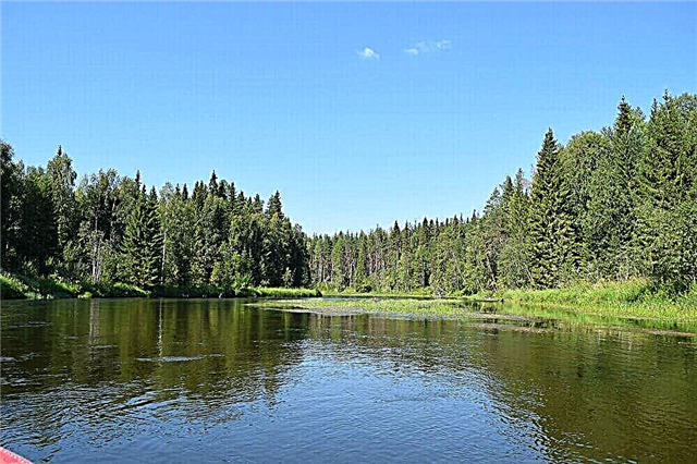
Ob
The main river of the Tyumen region is of great importance for the region. There are several large cities on it: Nizhnevartovsk, Surgut, Salekhard. The river is navigable. In the north of the region it flows into the Kara Sea, forming the Gulf of Ob, with a length of almost 800 km. More than 50 species of fish live in the Ob and Ob Bay itself, including valuable species: sturgeon, whitefish, sterlet.
The length of the river is 3,650 km, in the Tyumen region - 1,735 km.

Ishim
The longest tributary of the Irtysh flows through the territory of Russia and Kazakhstan. In the Tyumen region on the river there is a city of the same name, the center of the Ishim district. Here the river flows along the Ishim plain, along a wide floodplain zone with oxbows, swampy in the lower reaches. Navigation is carried out from the village of Vikulovo to the mouth of the river. The width of the river in some places reaches 200 meters. Ishim flows into the Irtysh along the left bank near the city of Ust-Ishimsk.
The total length of the river is 2,450 km.

Tobol
This tributary of the Irtysh is the first in full flow. It flows from Kazakhstan to Russia, the channel runs along a deep fault, therefore the right bank of the river is much higher than the left. The large Tyumen cities on the river are Yalutorovsk and Tobolsk. The Tobol flows along the Ishim plain, there are a lot of lakes in its basin, the width of the channel varies from 50 meters in the middle reaches to 300 meters in the lower reaches. The river and oxbows are rich in fish, and valuable species are found in the lower reaches.
The total length of the river is 1,591 km.

Pelvis
The river originates in the Siberian Uvaly, flows northward and flows into the Kara Sea. It is located in the Yamalo-Nenets Autonomous Okrug. The estuary forms a bay, the Taz Bay, and is fenced off from the sea by a shallow bar. The channel is very winding, often forks, the wide valley is swampy. Several types of fish are fished. From the mouth to the village of Tolka, the 798 km section is navigable.
The length of the river is 1,401 m.

Demyanka
The right tributary of the Irtysh originates in the swamps of the Omsk region, and then flows in the Uvat district of the Tyumen region. The upper reaches are called South Demyanka. The river flows in steep banks overgrown with dense taiga forests, often winds and winds, receives about 50 tributaries. The river valley is surrounded by swamps, old lakes, so the banks are poorly populated and retain their original appearance.
The total length of the river is 1,159 km.

Tour
The left and longest tributary of the Tobol is located in the Tyumen and Sverdlovsk regions. The river begins with several springs on the slopes of the Ural ridge, in the upper reaches the river is shallow and has a mountainous character. On the territory of the Tyumen region, the Tura flows along the plain, winds strongly, branches into channels. The capital of the region, the city of Tyumen, is located on the river. The Tura was the first river from which they began to conquer Siberia.
The total length of the river is 1,030 km.

Wah
The right tributary of the Ob, flowing through the territory of the Khanty-Mansiysk Autonomous Okrug. It originates in swamps at the watershed of the Ob, Taz and Yenisei. The estuary is located 10 km above Nizhnevartovsk, and the largest oil field on the river, Samatlorskoye, is also located here. More than 50% of the river valley is occupied by oil production infrastructure. In the upper reaches of the Vakh, it has not been developed, the places here are inaccessible, the forests are rich in fur animals.
The length of the river is 964 km.

Tavda
The river originates on the eastern slope of the Middle Urals, in the Sverdlovsk region. It flows from the northwest to the southeast and flows into the Tobol along the left bank. The river is used for navigation; earlier, timber was rafted along it, which is why there are areas littered with snag. It flows through sparsely populated swampy areas, often winds. The right root bank is high, with cliffs up to 50 meters. Tavda is rich in fish, commercial fishing is widely developed.
The total length of the river is 723 km.

Iset
The river flows from Lake Isetskoe in the Urals strictly to the east. It flows into the Tobol along the left bank near the village of Pamyatnoye, in the Yalutorovsky district of the Tyumen region. In the interfluve of Tobol and Iset, there is the famous Ingalskaya Valley - a large archaeological site. The river gave its name to the village of Isetskoe, the administrative center of the Isetsky district of the Tyumen region. On the territory of the region, the Iset receives more than 10 tributaries.
The total length of the river is 606 km.

Pyshma
The right tributary of the Tura flows from the Urals to Siberia. It is located on the territory of the Sverdlovsk and Tyumen regions. In the upper reaches, it is especially picturesque due to rocky cliffs and cliffs, and in the flat part of the coast it is surrounded by a forest-steppe with pine-birch forests. In the Tyumen region, the middle and lower course of the Pyshma passes, here it often meanders, the banks are sparsely populated. There are several small villages on the river.
The total length of the river is 603 km.

Wagai
The river originates from Lake Ryamovskoye in the south of the region, flows through the territory of four districts of the Tyumen region and flows into the Irtysh along the left bank 55 km above Tobolsk. There are many small settlements on the river. At the mouth is the Ermakova creek - the place of death of Ermak. Wagai has one more mouth - an artificial one, dug for timber rafting. A part of the Transsib passes through the upper course in the valley.
The length of the river is 555 km.

Pur
A river on the territory of the Yamalo-Nenets Autonomous Okrug. It originates from the confluence of the Pyakupur and Aivasedapur rivers, in this place is the only city on the river - Tarko-Sale. It flows into the Taz Bay, forming a multi-arm delta. Together with numerous tributaries, the Pur forms a wide floodplain, the channel in some places reaches 850 meters in width. The river flows through undeveloped areas, in the tundra and northern taiga zones.
The length of the river is 389 km.

Imgyt
The left tributary of the Demyanka River is located in the Uvat District of the Tyumen Region. It flows through the Vasyugan plain, among endless swamps. The coast is practically not inhabited, there is only one village on the river - Gerasimovka. The Imgyt receives over 200 small tributaries. The channel width does not exceed 15 meters. There are pike, perch, and dace in the river.
The length of the river is 304 km.

Turtas
The river is formed by the confluence of the Bolshoi and Maly Turtas rivers, which originate in the Imgyt bog. It flows into the Irtysh along the right bank near the village of Uvat. It is completely located in the Uvat district of the Tyumen region. It flows to the northwest, across the territory of the Vasyugan Plain, among the swampy taiga. The channel is winding, not wide. The settlements are located only in the lower reaches, the largest of them is the village of Turtas.
The length of the river is 241 km.

Suit
A river in the Nizhnetavdinsky and Yarkinsky districts of the Tyumen region. It flows into the Tobol along the left bank near the village of Yarkovo.On the river there is a village and a village with the same name. On its way, it receives 6 tributaries, by a channel it connects with the Yantykovo Lake. Iska is well known among Tyumen fishing lovers; pike, perch, and crucian carp are caught here.
The length of the river is 210 km.

Lime
The river is located in the Tyumen and Sverdlovsk regions. It starts from Lake Maloe Satykovo and passes through a whole chain of lakes. Once in the Tyumen region, it turns north and flows along the swampy plain. It flows into the Noska River along the right bank near the village of Laitamak in the Tobolsk region. These places are called "swamp", there are no roads connecting with the mainland, communication only by water or air.
The total length of the river is 200 km.

Tap
The right tributary of the Tobol, located in the Yurginsky district in the south of the Tyumen region, flows through the Tobol-Ishim plain. The river is shallow: from 0.5 meters in winter to 3 meters during spring floods. Several small rivers flow into Tap, which dry up in summer and become streams with swampy banks. On the river, among the endless Siberian forest, there is the village of Novy Tap, the main direction of development of which is the timber industry.
The length of the river is 189 km.

Emets
A river in the Berdzhsky and Golymshanovsky districts in the southern part of the Tyumen region. It flows out of Lake Istoshino and flows into the Vagai River along the right bank. There are several settlements on the river. About 10 small tributaries flow into the Yemets, including the Maly Yemets, near the village of Melkozero. The river is inhabited by crucian carp, perch, pike, and chebak.
The length of the river is 132 km.

Scourge
The right tributary of the Irtysh flows through the territory of the Omsk and Tyumen regions. It originates in the Imgyt bog and flows into the Irtysh at 934 km. In the Tyumen region, a section of the river passes through the Uvat district. Now Beach is not navigable, but it used to be used for timber rafting. The average width is 10 meters, pike and perch are found in the river.
The total length of the river is 160 km.

Nerda
The right tributary of the Tobol River flows through the territory of the Yarkovsky and Tobolsk districts of the Tyumen region. It flows out of Lake Yurgarkul and flows to the northwest. The estuary is located near the village of Aksarina, Yarkovsky district. The river is not wide, but it overflows strongly during the flood of Tobol, at this time there are many fish in it. Carp, pike, perch are caught.
The length of the river is 142 km.

Tevriz
A small tributary of the Turtas is located in the Vagaysky and Uvatsky districts in the south of the Tyumen region. At first it flows to the east, in the second half of its length it changes direction to the north. The channel is not wide, very winding, winding among dense forests. Translated from the Khanty language, Tevriz means "dark water".
The length of the river is 132 km.

Karasul
A river in the Ishim district of the Tyumen region. The name comes from the Turkic language and means "dark water". The source of the river is in the swamps on the border of the Ishim and Golyshman districts. It flows through the Ishimovskaya valley, in the forest-steppe zone. It flows into Ishim along the left bank near the village of Borovoe. There are several settlements on the river, including the old Cossack village of the same name.
The length of the river is 128 km.

Yurga
River in Yarkovsky, Yalutorovsky and Yurginsky districts. The administrative center of the latter, the village of Yurginskoye, stands on this river and bears its name. It receives 5 small tributaries, the largest being the Spouse and the Dill. It flows into the Tobol along the right bank. The river has a shallow depth and width, but it overflows in spring, during the flood period, carp, ide, pike are found here. The Yurginsky complex reserve was founded on the shores.
The length of the river is 127 km.

Yemurtla
A river in the Uporovsky district of the Tyumen region. The source is in the Kislom bog. The right tributary of the Tobol, the mouth is located near the village of Novaya Shadrina. There are 13 villages and settlements on the river. In the village of Ermutla, as well as in Bunkovo, Suklema and Krasheninino there are bridges across the river. The most significant tributaries: Nerpa, Kizak, Kurchigay, Koshair. Chebak, dace, perch are caught in the river.
The length of the river is 106 km.

Niyap
A small river originates in the Kurgan region. In the Tyumen region, on the territory of the Uporovsky district, there is about a quarter of its entire length. Here Niyap flows into Tobol along the left bank. The name of the river is associated with the legend about the daughter of the Siberian khan. There are three small settlements on its banks.
The total length of the river is 77 km.

Beshkil
The left tributary of the Iset, originates from the lake near the village of Kirsanovo. In the interfluve of the Beshkil and Iryum rivers, there used to be Old Believer settlements. Preserved information about the ancient Beshkil settlement, which was located at the confluence of the Iset. Here the Old Believers mined white clay. Today there is a rural settlement Sloboda-Beshkil, belonging to the Isetsky district.
The length of the river is 54 km.

Uk
A small river in the Zavodoukovsky district of the Tyumen region, from which the regional center got its name, founded after the construction of factories on the Uka. There is a unique Kolmakovsky park in the city on the river bank. The word "uk" itself is translated from Tatar as "arrow". The river is not wide, it flows along the plain in the high banks, along the meadow zone. It flows into Tobol along the right bank below the village of Gilevo.
The length of the river is 55 km.

Akhmanka
The left tributary of the Tura flows in the Nizhnetavdinsky and Tyumensky districts. At the mouth is the village of Salairka, an old Tatar settlement known since the 17th century. Since ancient times, timber has been rafted along the river, there were several mills on it. On the right bank of the Akhmanka there is a natural monument "Eagles tract", a complex of relict forests of fir, Siberian pine, spruce.
The length of the river is 53 km.

Shestakovka
Left tributary of the Tobol. It is formed by the confluence of the Chambair River and a small unnamed river. It flows through the territory of Yarkovsky and Tobolsk districts, in remote, inaccessible places. There is a bridge across Shestakovka near the village of Seity. The river flows on the plain, often winds and changes its direction.
The length of the river is 50 km.