There are many beauties and places for recreation in the Krasnodar Territory. The Black Sea coast provides so many opportunities for tourists to spend time interestingly or relax that some other natural sites remain in the shadows. The same can be said about the rivers of the region. Among them there are truly significant waterways used for household needs. However, their contribution to the tourism industry is minimal.
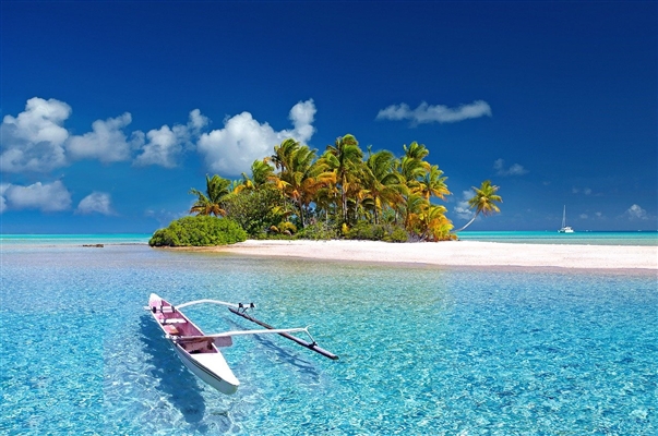
Reservoirs attract fishermen, because most bite is good. Artificial ponds have even been created in Chelbas for the convenience of fishermen. Not far from the Abin channel, you can find places related to the culture of the Shapsugs and Circassians. During the season, the Malaya Laba is crowded with fishermen, hiking and rafting. And nature lovers must visit Pshekha and its huge waterfall.
The longest rivers of the Krasnodar Territory
List of the largest waterways flowing in the region.
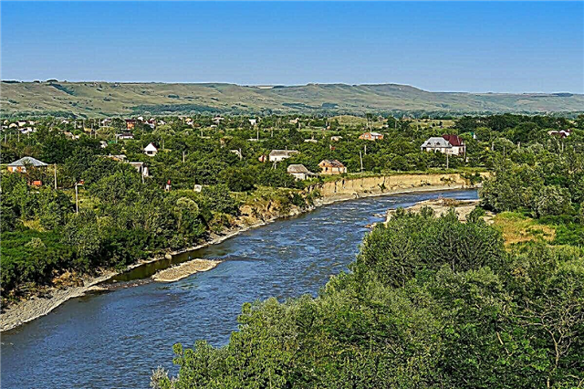
Kuban
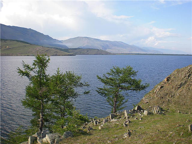
It originates in the mountains of Karachay-Cherkessia. Refers to the basin of two seas. The shores are heterogeneous: dense thickets give way to almost deserted terrain. At the same time, areas convenient for setting up tents are found almost along the entire channel. Fishing attracts travelers from different regions, the best time for a bite is autumn.
The length of the river is 870 km, in the Krasnodar Territory - 662 km.

Her
Formed from the confluence of Karasun and Upornaya. Although Eya freezes in December, ice drift is usually not observed. On the channel, river ponds are formed, which are used by local residents for fishing. There are legends that the river was larger in the past, large ships sailed along it. Allegedly, some of them sank, and treasures can be found somewhere among the silt. Adventure seekers make forays here during the warmer months.
The total length of the river is 311 km.

Chelbas
It flows out of the Mirsky pond. Near the Sea of Azov, the river forms small estuaries. On the channel, dozens of ponds have been artificially created, which are used for fishing and watering. In the distant past, Chelbas was completely different: deeper, wider and with a rapid current. The current period is considered the time of extinction of the reservoir. The ecology in the area of the river is constantly deteriorating.
The length of the river is 288 km.

White
Left tributary of the Kuban. The source is located near the Oshten and Fisht mountains. A cascade of hydroelectric power stations was built on the riverbed. Belaya is actively explored by tourists. Especially crowded in the area of waterfalls and picturesque canyons. The rocks next to the river are suitable for ascents, there are specially paved routes for beginners. White is called the "mistress of the mountains", many legends are associated with it, which are told by local guides during excursions.
The total length of the river is 273 km.

Pshish
There is no exact length data. This is due to the construction of the Krasnodar reservoir, as a result of which the Pshish channel was reduced. In the lower reaches, the current is smooth. In the upper and middle reaches, there is an alternation of deep reaches and rifts. Such a feature of Pshishi is a good luck for those who like kayaking. The river freezes in places, even when frosts that are strong for this area rise.
The total length of the river is 258 km.

Baseug
It flows into the Sea of Azov, before passing through two estuaries in succession: fresh and salty. The channel is characterized by strong thickets. A system of dams is organized on the tributaries of the river. In the winter months, Beysug can freeze, but there is no ice drift: the ice is not thick and melts quickly. When the wind blows from the west, sea water enters the river. The coast is densely populated, like the entire valley.
The length of the river is 243 km.

Urup
Not far from Armavir it flows into the Kuban. In the upper reaches of the Urup there is a typical mountain river, but already in the middle the course becomes flat. Sometimes it freezes, but not every year. The main attraction of the area is the Triangular Cave. It contained tools and animal bones processed by fire. This gave an idea of the ancient people who inhabited the area 600 thousand years ago or more.
The total length of the river is 231 km.

Laba
Formed at the confluence of Malaya Laba and Bolshaya Laba. In the upper reaches, the current is stormy, and the channel passes through the gorges. The flat part of the river is characterized by an extensive network of tributaries. In the lower reaches, conditions have been created for growing rice, the area is divided into special areas flooded with water - rice checks. However, they are not currently used. The bridge thrown across the Laba is 4.4 km long.
The total length of the river is 214 km.

Bricks
The source is located in the village of Yuzhny. As such, there is no mouth: the river spreads over swampy areas. The channel is very meandering in the flat part and is heavily covered with water-loving vegetation. One of the sites has a chain of estuaries and ponds. The Kirpili basin is partitioned off by 330 structures, such as dams and dams. Artificial ponds are used in farmland irrigation and fishing.
The length of the river is 202 km.

Baseball Left
Refers to the left tributaries of the Beysug River, hence the name. Cossacks began to deepen the streams by hand in the past centuries. Currently, the reservoir looks more like a chain of ponds connected to each other than a full-fledged river. Some areas are particularly picturesque and oasis-like. Where there are no thickets of reeds, the channel is suitable for resting by the water, there are sites for setting up tents.
The length of the river is 161 km.

Nipple
The largest tributary is Ei. The name of the river can be translated as "smelly". The reason lies in the groundwater rich in hydrogen sulfide. They nourish Sucker and make the area not always smell good. Mineralization is increased and exceeds the indicators of other rivers in the region. The channel needs cleaning. Due to the abundant thickets of reeds and other aquatic and semi-aquatic plants, all fish may die.
The length of the river is 159 km.

Psecups
One of the left tributaries of the Kuban. The popular resort of Goryachy Klyuch is located in the river valley. Its surroundings are especially picturesque. There are outlets of hydrogen sulphide springs on the channel. In these places, the color of the water changes to a dull green and a characteristic odor appears. Psecups is used for alloys. Research has been carried out to identify factors that negatively affect the ecology in the area of the river.
The total length of the river is 146 km.

Duct
The right sleeve of the Kuban. Serves as a natural border between the regions of the region. The mouth is the Sea of Azov. At different times and among different peoples, the river bore other names, including Kara-Kuban, Kumli-Kuban and Kumuzun. Although the river is navigable along its entire length, this feature of the Channel is practically not used. Water from the sleeve is used for irrigation of rice fields, less often for desalination of estuaries.
The length of the river is 140 km.

Pshekha
One of the left tributaries of the Belaya. It originates near Belorechensk. Pshekhi waterfall is a place of tourist pilgrimage. Its height is about 165 meters. The mountainous terrain and picturesque valleys make walks in the area unforgettable. There are special hiking trails. There is controversy about the translation of the name. It supposedly means "to carry a spear" and refers to a major battle.
The total length of the river is 139 km.

Malaya Laba
Refers to the Kuban basin. It carries its waters, among other things, through the territory of the Caucasian Biosphere Reserve. Rushing towards the valley, Malaya Laba passes through deep gorges. The shores are mostly gentle with lush vegetation. During the season there are many tourists: fishermen, lovers of camping and rafting. In hot months, the water level decreases, but only slightly.
The length of the river is 133 km.

Angelinsky Erik
It is part of the Kuban irrigation system. Erik in a general sense is a narrow channel connecting water bodies. The forest in which the Angelinsky erik originates is called either Red or Black. Hunters come here in season and camp. Anglers should plan their visit carefully: when the locks are open, there is not much fun. There are 2 villages and several farms along the banks.
The length of the river is 116 km.

Curgips
It is a left tributary of the Belaya.The name is translated simply - "mountain river". The canyons and gorges through which Kurdzhips flows are a real boon for those who love breathtaking landscapes. The valley is covered with dense forests, and in the upper reaches there are pastures and hunting grounds. More than 80 tributaries make the river independent of precipitation, so it is full-flowing all year round.
The total length of the river is 100 km.

Depressed
It flows through the territory of the Kalininsky and Dinsky districts. Dams split the channel into sections that have become separate ponds. Previously, some of them were used for breeding fry. Ponura flows into the estuary of the same name. By its nature, the river is more like a mountain river than a flat one. At the same time, the coast is an alternation of hills and valleys. The area is characterized by a variety of species of herbs.
The length of the river is 97 km.

Afips
Left tributary of the Kuban. Due to improperly functioning locks of the Shapsug reservoir, the river overflows more and more during floods and erodes its banks. You won't see fishermen here, but there are rare duck hunters. In winter, the river is covered with ice for about a month. In the Afips basin, mineral springs were found, comparable in properties and composition with the "Essentuki".
The total length of the river is 96 km.

Mzymta
The deepest and longest river in the country of those that flow directly into the Black Sea. In 1917, a trout breeding farm was organized here, which functions to this day. Lovers of rafting and other extreme water species come to the river. The slopes of the nearby mountains are perfect for skiing or snowboarding. It is not far from here to Krasnaya Polyana.
The length of the river is 89 km.

Hodz
Left tributary of the Laba. Shallow, but in some areas it is better not to go into the water - the current can knock you down. But on the shallows you can even relax with children: Hodz quickly warms up and practically freezes. Tourists are attracted by the waterfalls formed in the upper reaches of the river. It is also worth visiting the Moss-covered Spring Hill and horseback riding.
The total length of the river is 88 km.

Abin
It flows into the Varnavinskoe reservoir. Along the river bed, there are memorable places associated with the culture of the Shapsugs and Circassians. Popular among tourists are both one-day and multi-day excursions in jeeps. Closer to settlements, the water is calm, although there are also fast currents. The river gains its maximum strength during floods. Abin is rich in fish, there are separate areas where crayfish are caught.
The length of the river is 81 km.

Cavalier
Right tributary of Ei. An increase in water salinity during low-water periods is characteristic. In the area of Shaumyanovsky there is a section of the channel where the river itself is not visible due to cattails and reeds. There are shoals, but for the most part you can swim, use boats and fish. The banks are sometimes covered with vegetable gardens and orchards. At the source there are springs that fill the Kavalerka with crystal clear water.
The total length of the river is 78 km.

Adagum
It originates at the confluence of Neberjay and Bakanka. Due to the construction of the Varnavinsky reservoir, the river has lost many tributaries. In especially hot weather, Adagum partially dries up. At the same time, heavy rains - the main source of food - can cause flooding of nearby territories. The shores are not of particular interest for tourists, but the inhabitants of the region are chosen here for recreation.
The length of the river is 66 km.

Albashi
It starts 15 km from the village of Leningradskaya. The bottom is heavily silted, the water salinity is increased, and the coast is covered with reeds. Since the river is fed by melted snow and rains, the water level is subject to severe fluctuations and depends on the season. The floodplain has typical meadow vegetation with sparse shrubs. The bite is good in the season, there are pike, pike perch, carp.
The length of the river is 64 km.